Abstract
Background
Our team tackles three of the Sustainable Development Goals (SDGs) defined by the United Nations to improve food security in African regions with freely available resources provided by the New Space Economy.
- SDG 2: Zero Hunger - End hunger, achieve food security and improved nutrition and promote sustainable agriculture
- SDG 13: Climate Action - Protect, restore and promote sustainable use of terrestrial ecosystems, sustainably manage forests, combat desertification, halt and reverse land degradation, and halt biodiversity loss
- SDG 15: Life on Land - Protect, restore and promote sustainable use of terrestrial ecosystems, sustainably manage forests, combat desertification, halt and reverse land degradation, and halt biodiversity loss
"Food security" is defined by:
- Food availability in sufficient quantities
- Stability of that supply
- Economic and physical accessibility of food
- Food quality and safety
Rwanda was selected as the primary study area due to its unique position at the intersection of agricultural opportunity, food security challenges, and emerging national space capabilities. Agriculture accounts for over 60% of Rwanda’s employment and nearly one-third of its GDP, yet the country remains vulnerable to climate variability, soil erosion, and periodic food insecurity. Its diverse topography and well-managed agricultural zones make it an ideal natural laboratory for analyzing vegetation health dynamics using remote sensing.
Rwanda also benefits from high-quality satellite data coverage and progressive data policies that enable Earth Observation research. Importantly, the establishment of the Rwanda Space Agency (RSA) in 2020 underscores the nation’s commitment to leveraging space technology for sustainable development, aligning perfectly with the UN Sustainable Development Goals. These factors collectively position Rwanda as an exemplary case for testing AI-driven vegetation monitoring and food security forecasting frameworks using Sentinel data and AI-based analytics.
Furthermore, threats imposed on agricultural yield (productivity) due to weather extremes and unpredictability, as a result of climate change, makes achieving food security ever more difficult. Hence the region is in great need of adoption of proper mitigation and adaptation strategies.
Mitigation: by accessing high resolution data on vegetation health, one can build early warning systems and provide intervention strategies.
Adaptation: prepare for the unavoidable. Develop strategies in which will help to adapt to the new environment.
Providing up-to-date valuable information on vegetation health would accelerate and help the development of mitigation and adaptation measures. Earth observation (EO) satellites could provide the relevant information needed. However, existing methods lack spatial and temporal precision.
Interpreting the enormous amount of down-link data from the EO satellites quickly is key. That is where AI becomes crucial. If trained well, such technology can provide the local communities with valuable up-to-date information on vegetation health. Therefore, farmers could move away from always reacting to unpredictable vegetation health, and therefore crop yield, to preventive measures (precision agriculture).
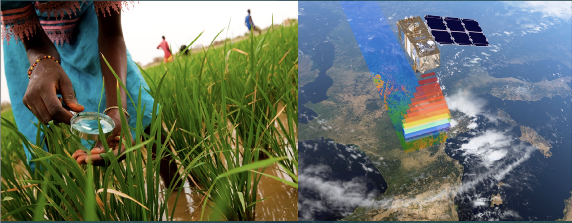
Our goal is to help these regions by analyzing free accessible satellite data with the help of AI. Currently, the European Copernicus program offers the highest resolution multispectral earth observation data via its Sentinel constellation. We aim to utilize Sentinel 2 in specific, coupled with free accessible data engines (Google Earth Engine) and AI. With this, our team would like to showcase that one can help local farmers in need, only by utilizing freely accessible data coming from European capabilities. It is crucial that the data is translated into valuable information to be able to develop preventive actions and countermeasures on time. If proven successful, the project could be scaled up to further regions in Africa and elsewhere around the world.
Methodology
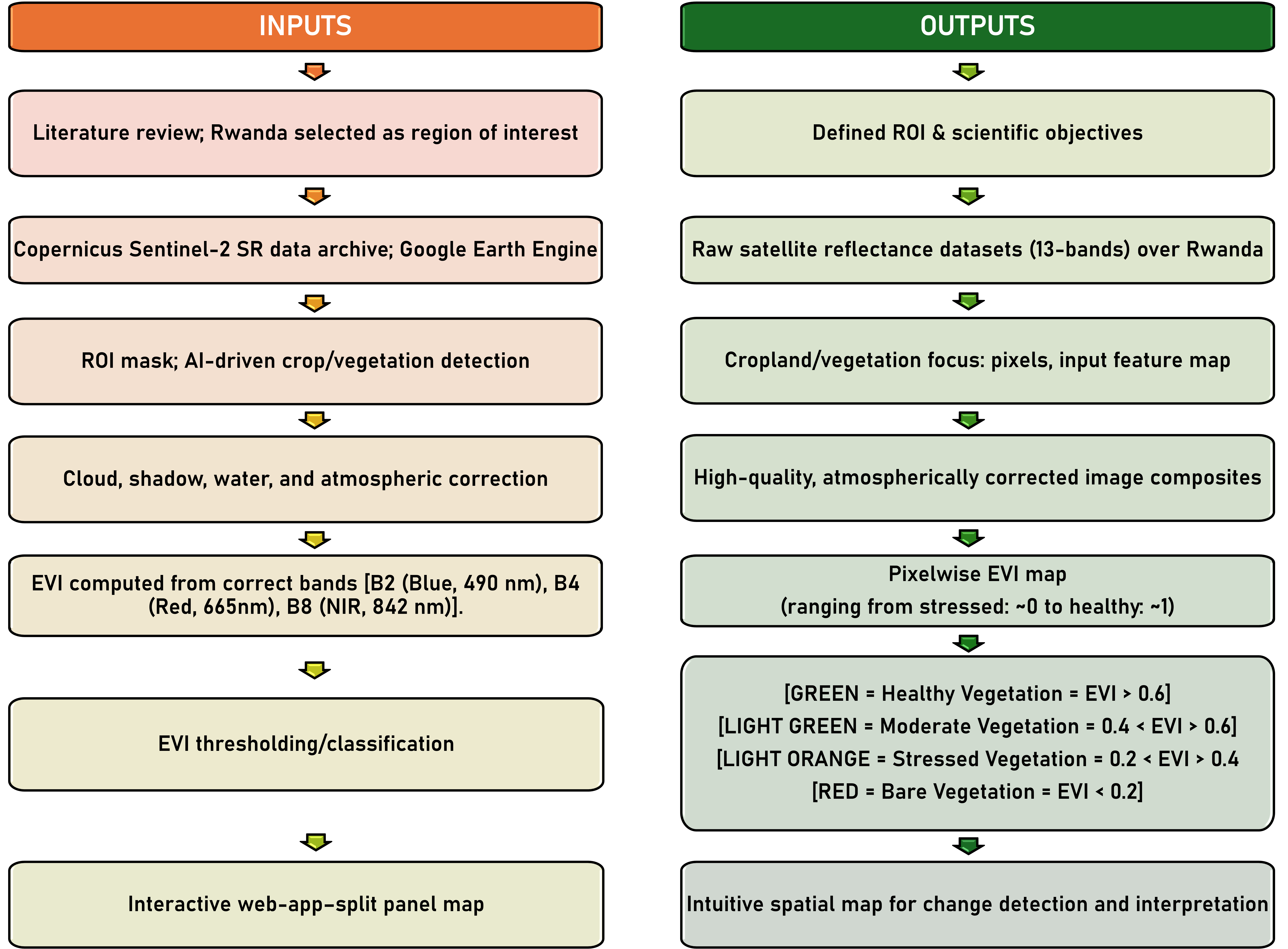
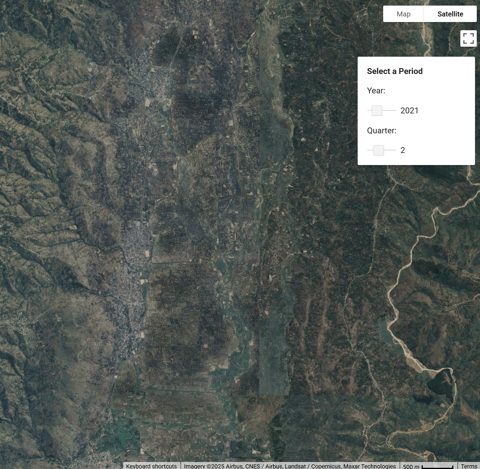
Satellite imagery of Bugarama Valley, Rwanda. Typical crops include rice, sugarcane, and maize. To switch between the satellite photo and the plant health classification, click the image.
Seasonal Vegetation Health Analysis
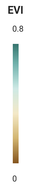
This video shows the Enhanced Vegetation Index (EVI) [0-1] evolution from 2020 to 2024 aligned with Rwanda's bimodal agricultural calendar.
This video shows how Google Earth Engine was used to determine the seasonal variations in vegetation health across Rwanda. The key in the bottom right corner shows how each color corresponds to a vegetation health category: Healthy (purple), Moderate (light blue), Stressed (yellow), and Bare (red).
Conclusion
This analysis realized an AI-driven vegetation-monitoring framework by utilizing open-access satellite data (Sentinel-2) and AI-based analysis (Google Earth Engine). This demonstrates that, through the use of free satellite imagery and AI, agriculture can evolve toward more sustainable and precision-based methods even if subjected to interannual weather and management.
Focusing on Rwanda for this case study, the Enhanced Vegetation Index (EVI) was calculated and visualized, and the area of interest was classified into four health categories.
The results demonstrate the potential application of low-cost and scalable agricultural monitoring.
This project aligns with and contributes to achieving the Agenda 2063 Goal-5 and SDG-2, which promote sustainable agriculture and food security in Africa.
Way Forward
- Phase I: Data & Information
- Phase II: Innovation & Deployment
- Phase III: Application & Impact
FUTURE ROADMAP: GeoAI for Food Security in Africa (2025–2035)
Vision: Establish a Pan-African GeoAI ecosystem integrating Earth Observation, Artificial Intelligence, and local knowledge to enhance agricultural productivity, climate resilience, and food security. The roadmap aligns with SDG 2 (Zero Hunger), SDG 13 (Climate Action), SDG 15 (Life on Land), and Agenda 2063 Goal 5 (Modern Agriculture for Increased Productivity).