Welcome to your brief tour of the Earth Engine Data Catalog, which contains decades of satellite imagery and much more. We will view some of the different types of data sets in the following sections, including climate and weather data, digital elevation models and other terrain data, land cover, cropland, satellite imagery, and others.
You can find a catalog of the datasets available in Earth Engine on this site.
https://developers.google.com/earth-engine/datasets/catalog
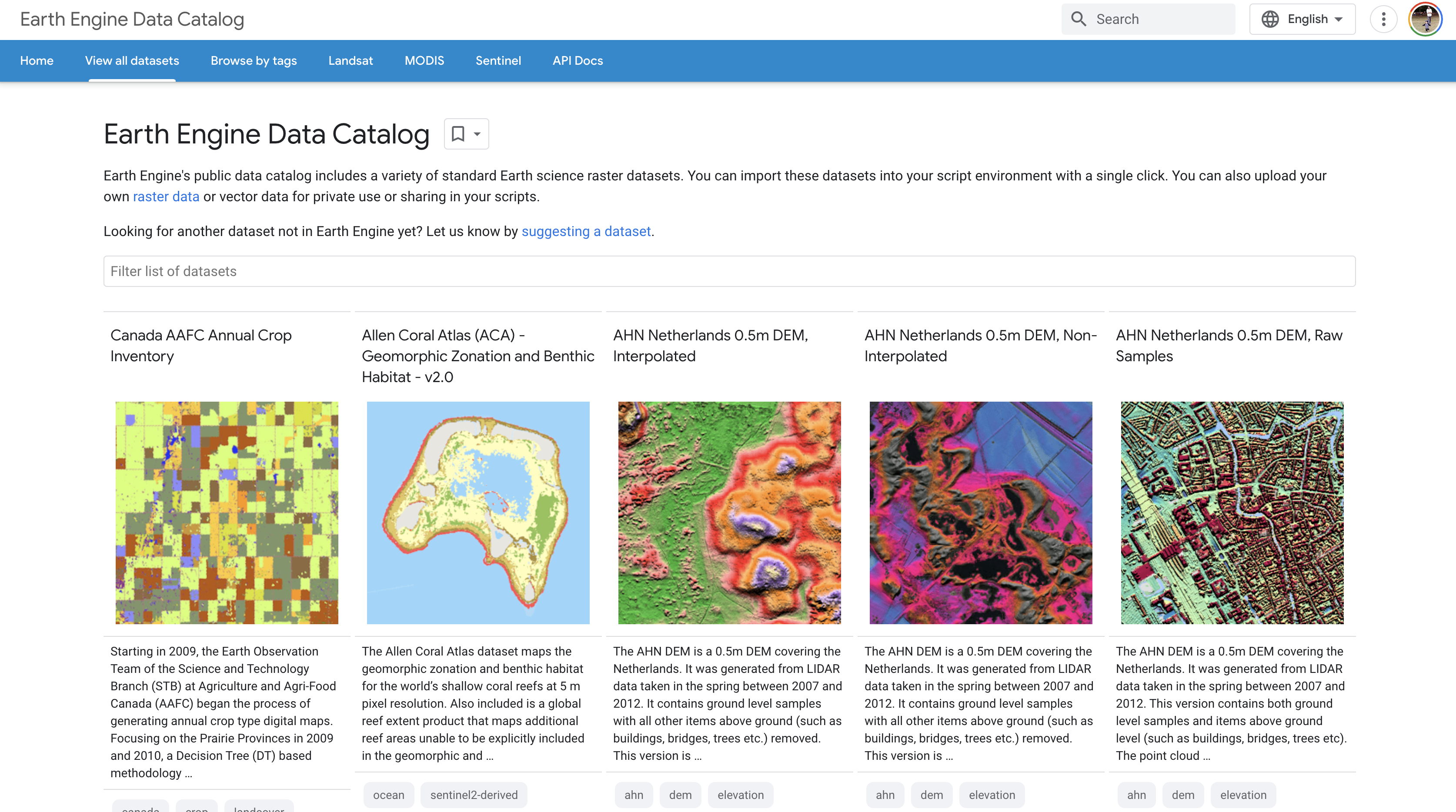
If you scroll down through the data, you will see all the different types of datasets available. Here you can click on any of the datasets to learn more about them. I am going to explore the elevation model of France.
https://developers.google.com/earth-engine/datasets/catalog/IGN_RGE_ALTI_1M_2_0
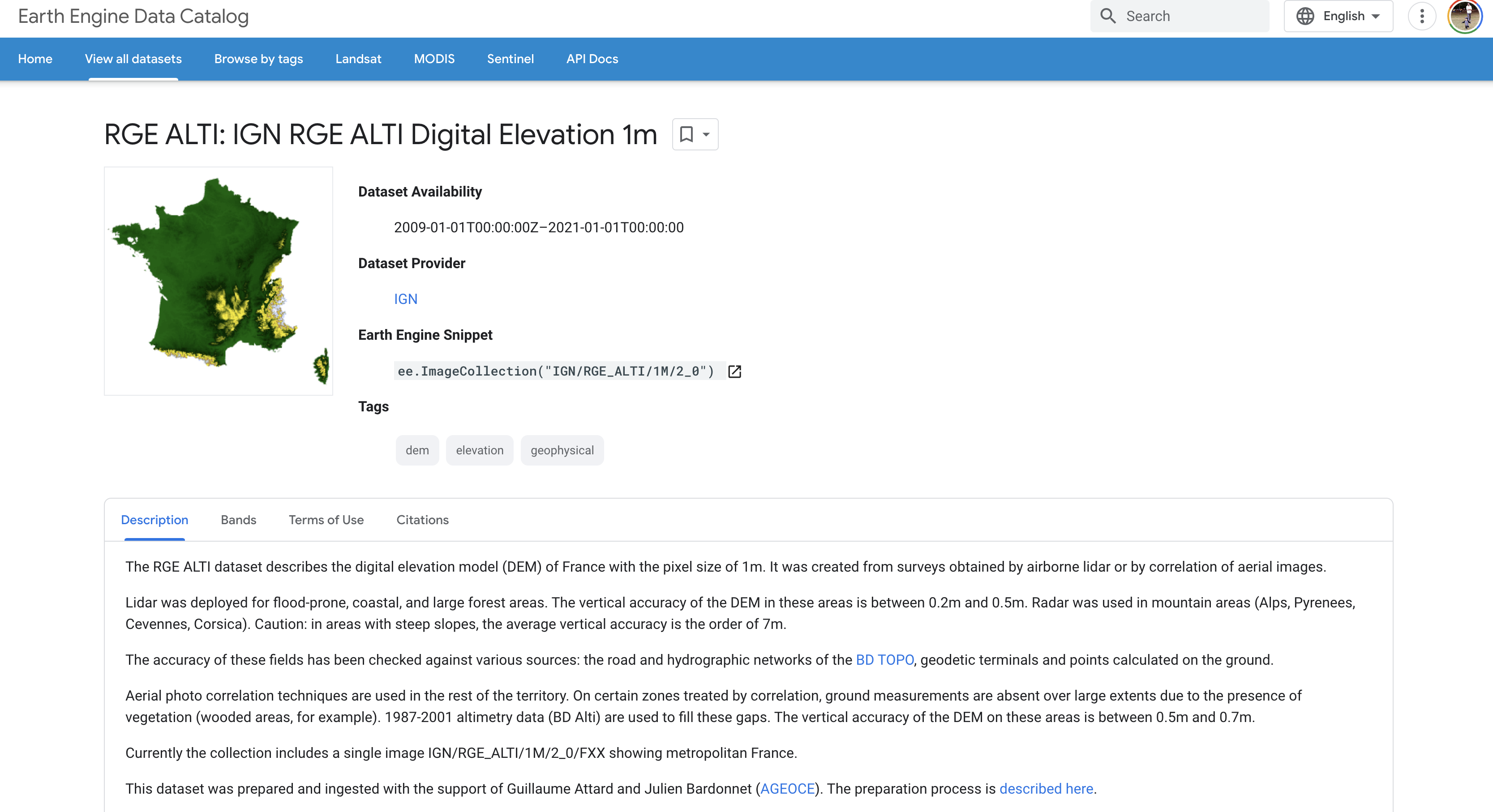
From this page, you can get all kinds of information. This is known as Metadata. Metadata in Geospatial Technologies refers to the structured data associated with geospatial data that provides information about the data, such as its origin, purpose, author, spatial and temporal extents, accuracy, format, and associated keywords. Metadata can also provide information about data processing, such as the software used to create it, the date it was created or updated, and other data about its usage. Metadata is important for managing, organizing, understanding, and sharing geospatial datasets. The data can be helpful for data sharing, analysis, and decision-making. Metadata helps to ensure that geospatial data is accurate and can be used for its intended purpose.
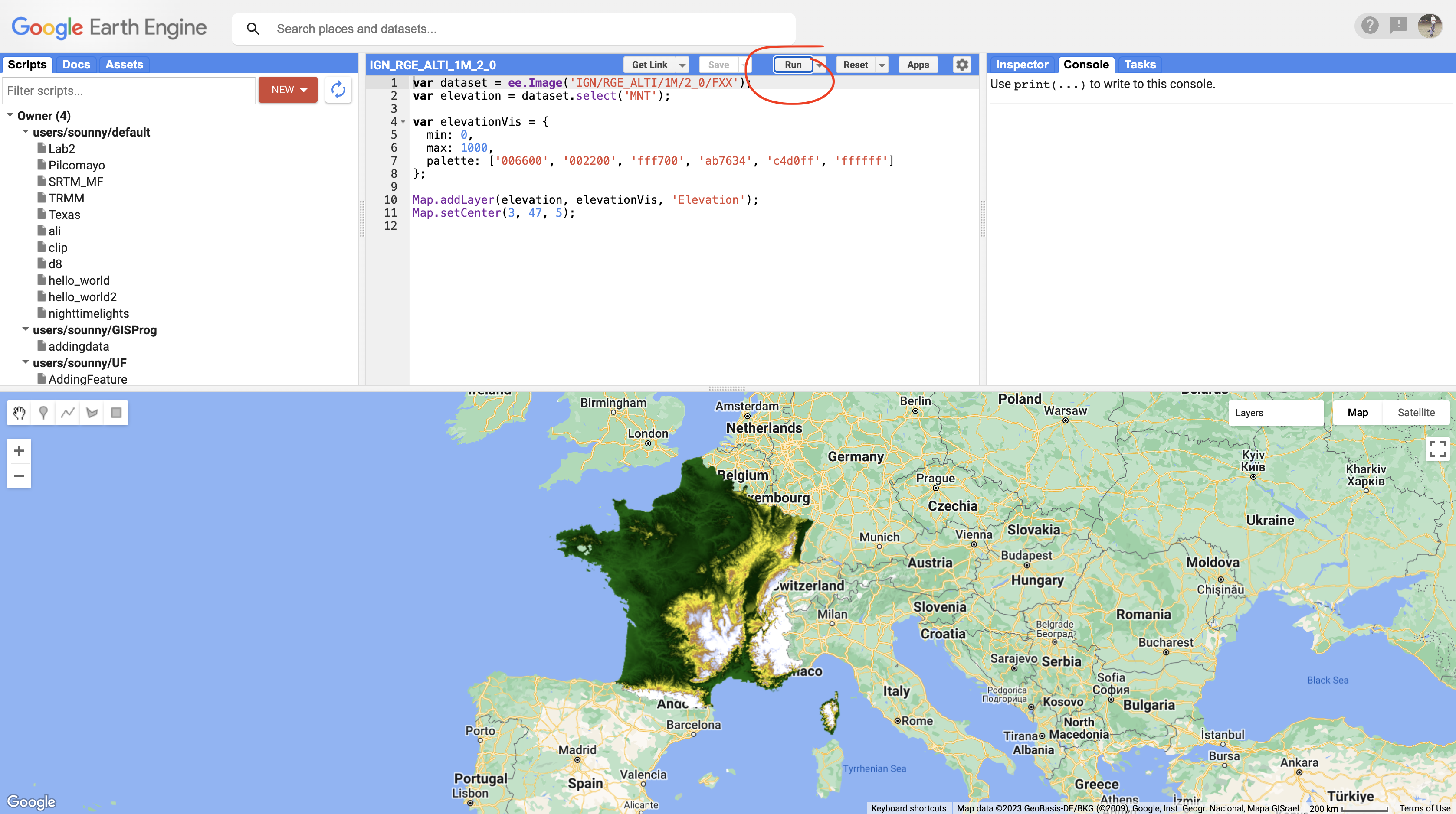
In Earth Engine, this Metadata page includes some sample code to add this image catalog and view the dataset. If you scroll to the lower part of the page, you will find this sample code.
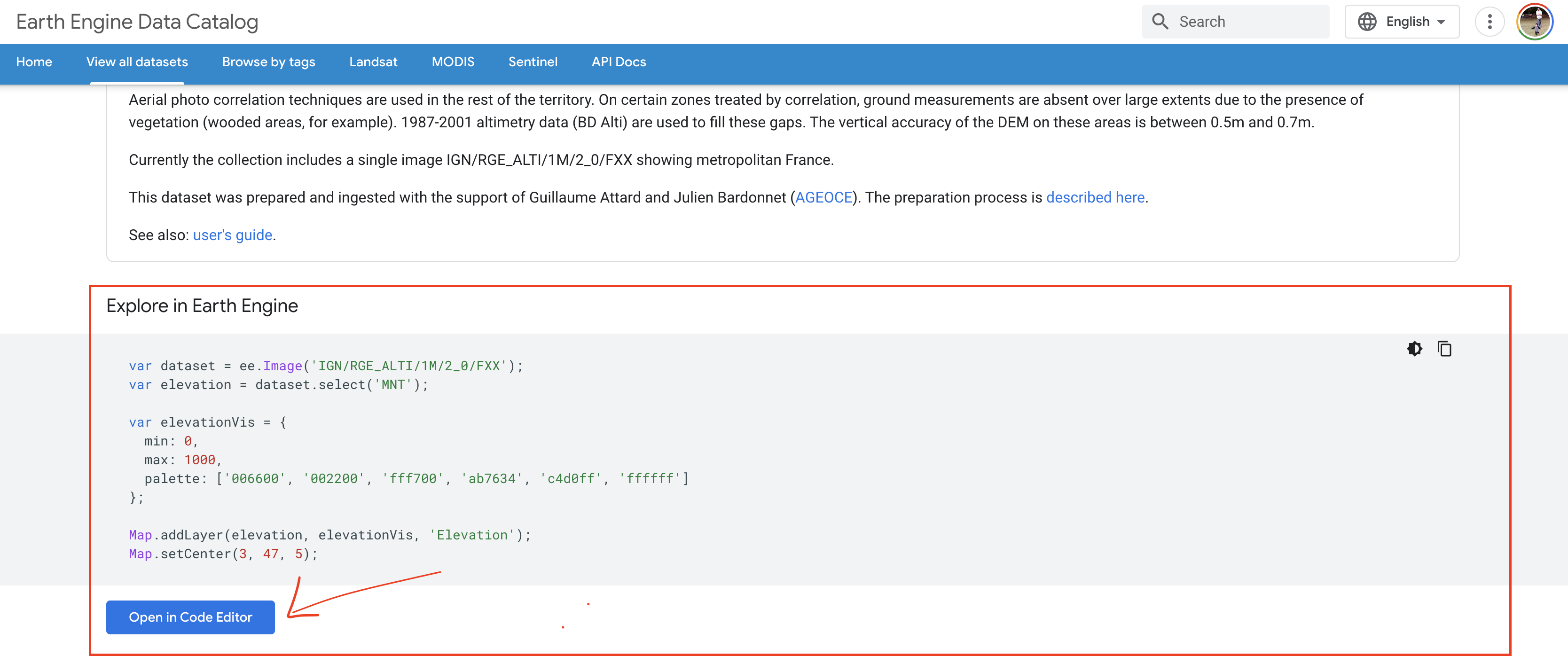
Examine the code, you can see how the imagecollection is access. First, a dataset is defined by calling the imagecollection ID. Investigating the 'Bands' tab in the metadata, you will see that the election data is set up on the MNT band. To access it, the second line of code uses the select method of the dataset object to select the MNT band. Now that we have isolated elevation in the memory, we are ready to visualize it. The elevationVis variable defines the elevation parameters, and then we use the addLayer method to add it to the elevation. The last line of code centers the screen on France.
By clicking on the Open in Code Editor, this sample code will open up in Earth Engine and allow you to see it in action. If you push the run button, you can see the data set open up.