The history of Remote Sensing, a story of data collection advancements, impacts analysis. 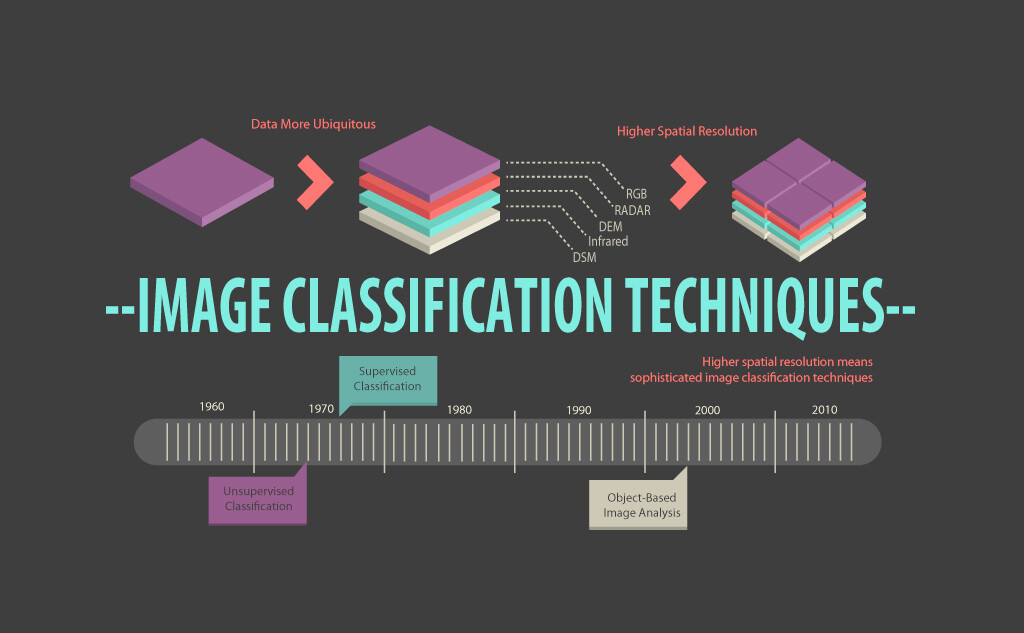
The application of image classification techniques in generating land cover and land use information has been prevalent since the 1980s (Li et al., 2014). However, the evolution of image classification has been driven by advancements in remote sensing products. With limited spectral, temporal, and spatial resolution, unsupervised classification was the most effective method. However, with the improved spectral resolution, the ability to analyze spectral signatures became more critical, leading to the emergence of supervised classification.
As remote sensing technology advanced, higher spatial resolution data became available, enabling more sophisticated techniques such as object-based image analysis (OBIA). Unlike pixel-based approaches, OBIA involves grouping individual pixels into meaningful objects based on spatial, spectral, and contextual characteristics. This approach provides more accurate and reliable information on land cover and use patterns, particularly in complex landscapes and urban areas.
Furthermore, integrating different remote sensing datasets, such as LiDAR, hyperspectral, and SAR, has further expanded the capabilities of image classification techniques. For instance, LiDAR data can provide detailed information on the vertical structure of vegetation, while hyperspectral data can provide information on the chemical properties of materials on the Earth's surface. Combining these datasets can lead to more accurate and comprehensive land cover and land use mapping.
Image classification techniques have evolved significantly over the years, driven by advancements in remote sensing products and data integration techniques. These developments have enabled more accurate and reliable land cover and land use mapping. This leads to the question about the future. What possibilities will come in Remote sensing with better data, and what analysis techniques will result from that?