Remote sensing is evolving quickly as sensors, cloud platforms, and AI advance. Use this overview as a roadmap for where to invest learning time after the core modules.
Learning objectives
- Identify emerging technical trends to watch.
- Connect skills from this course to next-step topics.
- Find trusted resources (papers, datasets, communities) to keep learning.
- Plan a lightweight personal roadmap for the next 3-6 months.
Why it matters
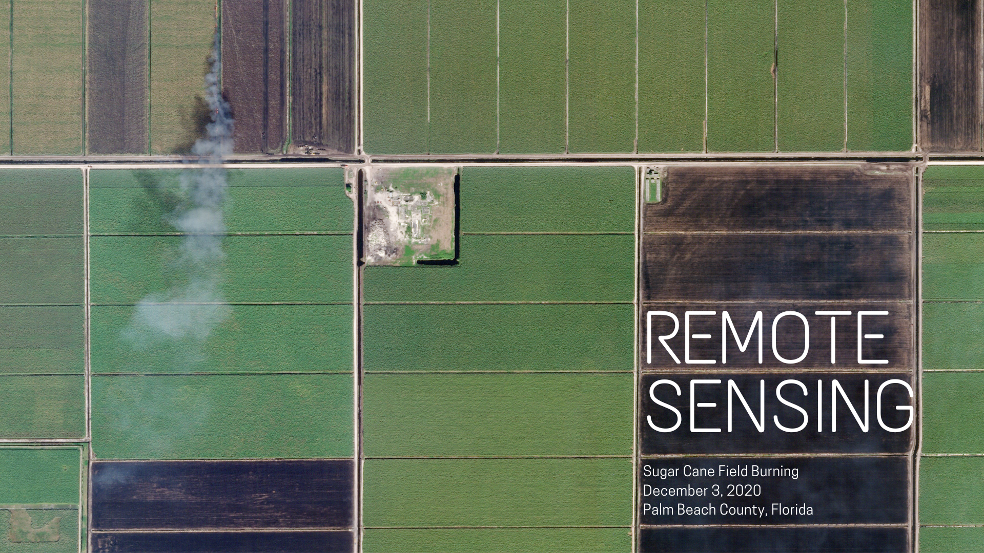
The tools, data, and expectations for remote sensing change yearly. Knowing the horizon helps you pick projects, stay relevant, and contribute to open communities.
Trends to watch
- Higher cadence and resolution: More daily imagery (Planet, Sentinel, commercial SAR) with finer detail.
- AI-native pipelines: Foundation models, self-supervised learning, and on-device ML for edge analytics.
- Fusion at scale: Optical + SAR + LiDAR + IoT data streams fused in cloud platforms.
- Open ecosystems: Growing open-source tools (geemap, rio, xarray) and open datasets.
- Responsible use: More focus on ethics, bias, privacy, and transparent methods.
Skills that build on this course
- Time series analysis (harmonics, trend + seasonality) on image collections.
- Machine learning for classification and regression (random forests, gradient boosting, deep nets).
- SAR fundamentals (polarization, speckle filtering, coherence change detection).
- Change detection workflows (pre/post composites, image differencing, stability masking).
- Data fusion (Sentinel-1 + Sentinel-2, LiDAR + optical, DEM + optical).
Pick a next-step project (30-60 minutes to scope)
Choose one real-world question, outline data + method, and note blockers:
- Question: What do you want to map or monitor?
- Data: Which collections (optical, SAR, DEM) and date range?
- Method: Composite, index, classifier, or change detection?
- Validation: How will you check results (ground truth, cross-source comparison)?
- Risks: Clouds, phenology, seasonality, resolution limits?
Where to learn more
- Earth Engine Docs: guides, reducers, charting, exporting, and Apps.
- Community forums: Earth Engine Developers Group; GIS Stack Exchange.
- Open courses/texts: EEFA Book (Fundamentals and Applications), USGS/ESA trainings.
- Packages:
geemap,rgee,rio-tiler,xarray.
Quick self-check
- Which trend above is most relevant to your interests, and why?
- What data sources would you fuse for a change detection project?
- What is one community or resource you will try this month?
Next steps
- Scan the bibliography for starter papers and reports.
- Draft a 3-week micro-project plan: data, method, output, validation.
- Share a Code Editor link or notebook with a peer and ask for feedback.