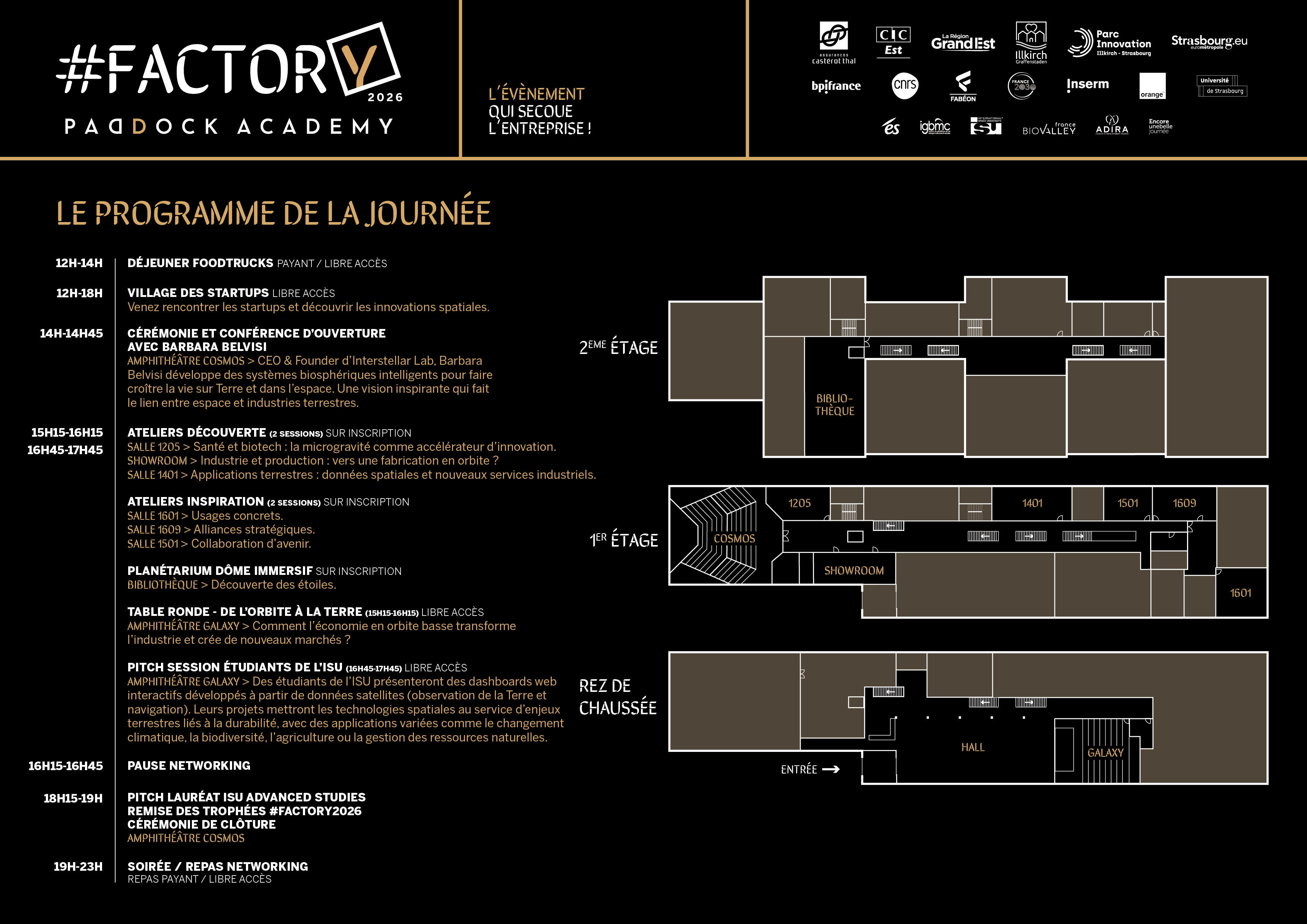
🚀 #Factory2026 Conference
🌅 10:00 - 12:00
Pitch Rehearsals & Final Polish: Selected teams rehearse for the main stage. All teams prep for the exhibition table.
Rehearsal
📖 Pitch Day Guide →
🎪 12:00 - 14:00
Startup Village, innovations, food trucks. Student Exhibition Table begins.
Open Access
Student Table
🎤 14:00 - 15:00
Opening Ceremony: Keynote by Françoise Pierrot (European Space Affairs Office, Prime Minister's Office)
Keynote
🌍 15:15 - 16:15
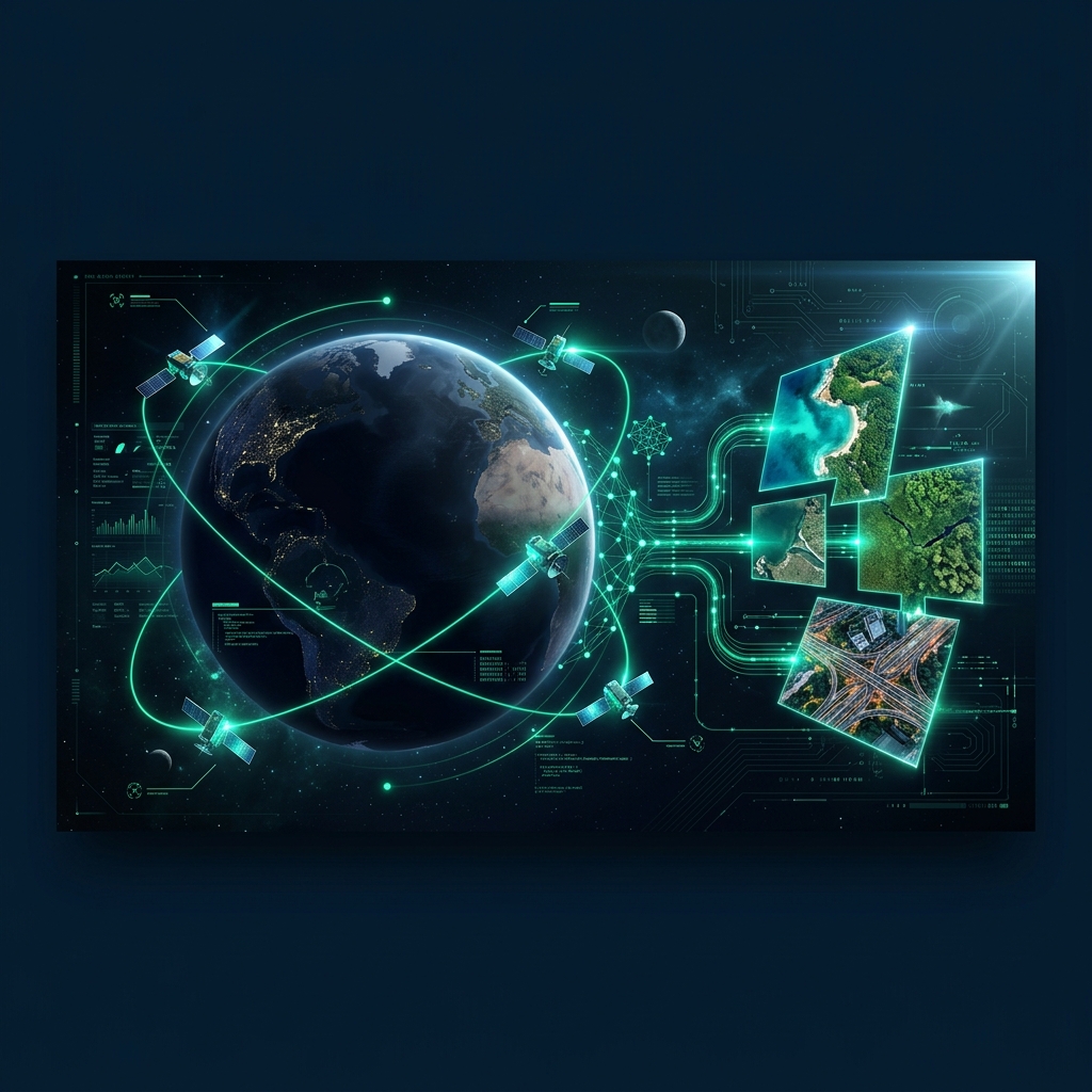
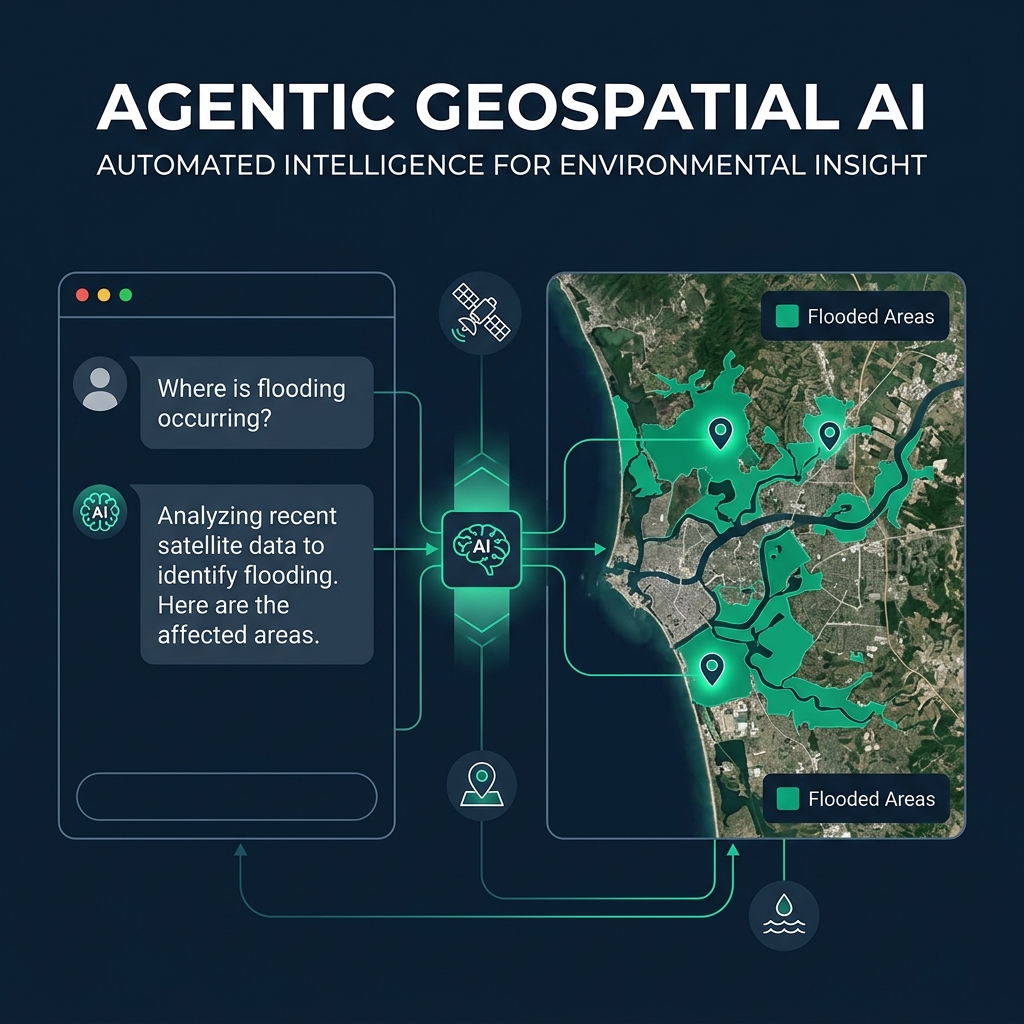
TERRA Workshop (Salle 1401): Led by Dr. Sounny. AI + Digital Twins for Earth Observation. Interactive demos.
Workshop
☕ 16:15 - 16:45
Coffee Break & Exhibition continuation.
🎯 16:45 - 17:45
Laureates Pitch (Amphitheatre Galaxy): Selected teams present mockups on the main stage to investors and industry professionals.
Pitch
🏆 17:45+
Closing Ceremony & VIP Networking Evening. Trophies & student business simulation pitches.
Networking