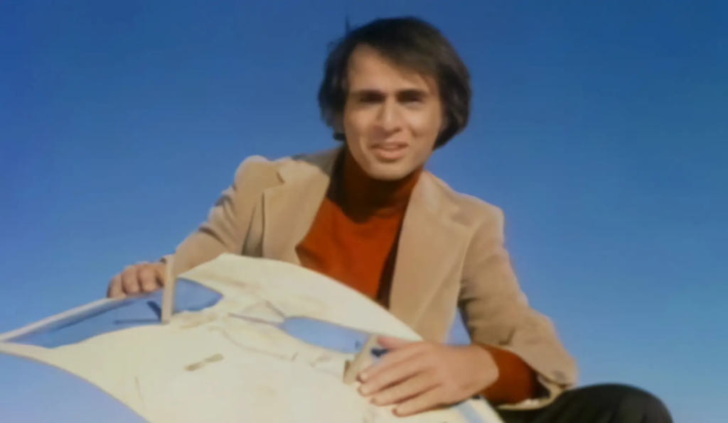
Watch: The Story of Eratosthenes
Before GPS, before satellites, before modern technology - one brilliant mind figured out how to measure our entire planet using only shadows, geometry, and ingenuity.
Who Was Eratosthenes?
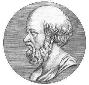
Eratosthenes of Cyrene
(c. 276–195 BCE)
Eratosthenes of Cyrene (c. 276–195 BCE) was an Ancient Greek polymath renowned for his contributions to mathematics, geography, poetry, astronomy, and music theory. As chief librarian at the famous Library of Alexandria in Egypt, he is often called the "Father of Geography" and made numerous contributions to science.
Born in Cyrene (modern-day Libya)
Appointed chief librarian at the Library of Alexandria
Wrote Geographika and coined the term "Geography"
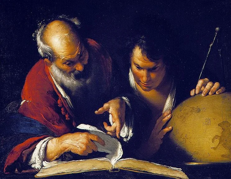
As the chief librarian at Alexandria's Library, Eratosthenes advanced geographical studies by introducing enduring terminology and creating the first global map with parallels and meridians — the same coordinate system we use today with GPS!
Image: Eratosthenes instructing a scholar in Alexandria
Calculated Earth's circumference with remarkable accuracy
Cataloged 675 stars and calculated the tilt of Earth's axis
Died in Alexandria at approximately 82 years old
Fun Fact: Eratosthenes also invented the "Sieve of Eratosthenes" - an algorithm for finding prime numbers that is still taught in computer science today!
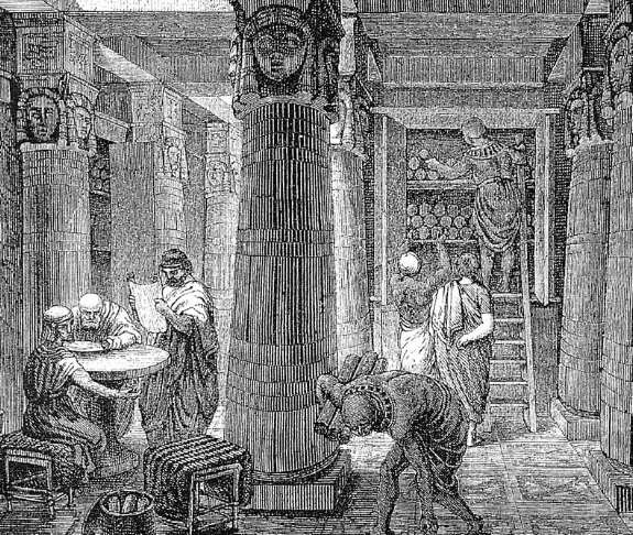
The Library of Alexandria, built during the early Ptolemaic Dynasty of Egypt, where Eratosthenes served as chief librarian
The World According to Eratosthenes (220 BC)
Eratosthenes is attributed with devising the first system of Latitude and Longitude. He produced this map based on his own calculations and reports from explorers like Nearchus and Pytheas.
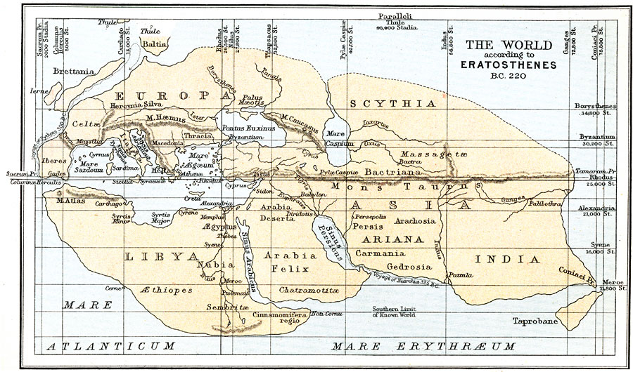
Source: University of South Florida - Maps ETC
The Brilliant Method
Eratosthenes learned that in the city of Syene (modern-day Aswan, Egypt), on the summer solstice at noon, the sun was directly overhead - so directly that it shone straight down into a deep well without casting any shadow. The sun's rays were perfectly vertical.
However, in Alexandria, where Eratosthenes lived (about 800 km north of Syene), the sun was NOT directly overhead on that same day. Objects cast shadows.
His Key Insight
If the Earth were flat, the sun would cast the same shadow (or no shadow) everywhere. But since Earth is a sphere, the sun's rays hit different parts at different angles!
The Geometry
On the summer solstice at noon:
- Syene: Sun directly overhead (0° shadow angle)
- Alexandria: Sun casts shadow at ~7.2° angle
- Distance between cities: ~5,000 stadia (~800 km)
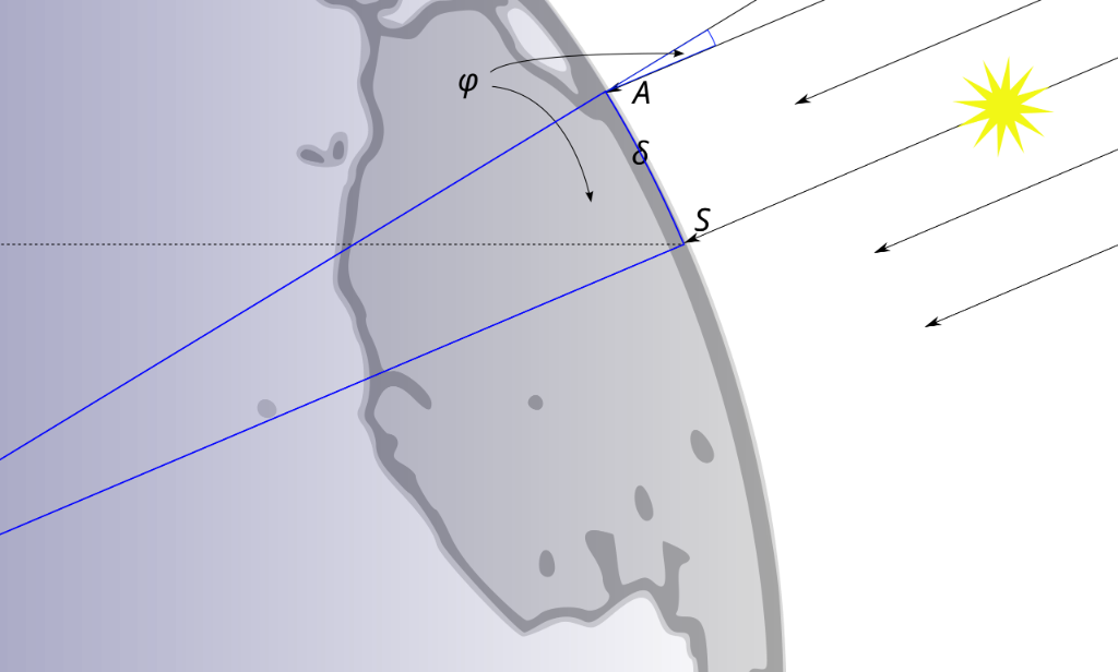
Geometric Representation: The sun's rays are parallel. Angle φ (phi) measured at Alexandria (A) by the shadow is equal to the central angle at the Earth's center. S represents Syene (Aswan). (Source: Wikipedia)
The Calculation
Eratosthenes reasoned:
- The 7.2° angle represents 1/50th of a full circle (360° / 7.2° = 50)
- Therefore, the distance between the cities (5,000 stadia) represents 1/50th of Earth's circumference
- Earth's circumference = 5,000 stadia × 50 = 250,000 stadia
How Accurate Was He?
Converting ancient units to modern measurements is tricky, but most historians estimate:
| Measurement | Value |
|---|---|
| Eratosthenes' Result | ~39,375 - 46,250 km* |
| Actual Earth Circumference | 40,075 km (equatorial) |
| Accuracy | Within 2-15% of actual value! |
*Depending on which definition of "stadion" is used
Remarkable Achievement: Using only a stick, shadows, and his brilliant mind, Eratosthenes calculated the size of our planet to within a few percent of the actual value - over 2,200 years before satellites!
From Shadows to Satellites
In this GPS workshop, you will recreate Eratosthenes' experiment using modern technology:
| Eratosthenes (240 BCE) | Your Experiment (Today) |
|---|---|
| Measured shadow angles | Measure GPS coordinates |
| Hired someone to pace distance | Pace distance yourself (count steps) |
| Used geometry to find angular difference | Use latitude difference from GPS |
| Calculated circumference using ratio | Calculate circumference using same formula! |
The Same Math, New Tools: The fundamental principle is identical - if you know a distance and the corresponding angle of Earth's curvature, you can calculate the whole circumference. Eratosthenes used the sun; you'll use GPS satellites orbiting 20,000 km above Earth!
Why This Matters
- Scientific Method: Eratosthenes demonstrated that careful observation and mathematics can reveal truths about our world
- Critical Thinking: He questioned assumptions (Is the Earth flat?) and designed an experiment to test them
- Applied Geometry: Abstract mathematical concepts (angles, ratios, circles) solved a real-world problem
- GPS Heritage: Modern satellite navigation builds on the same geometric principles that Eratosthenes used
Ready to try it yourself? Head to the Field Testing page to conduct Experiment 3: Calculate Earth's Circumference using your GPS unit!
🔧 Don't Have a Working Arduino GPS Unit?
No worries! You can still complete this lab using one of these alternatives:
- Web-Based GPS App: Use the GPS Web App on any device with GPS capabilities (laptop, tablet, or phone)
- Commercial GPS Unit: If you have a handheld Garmin, Magellan, or similar device
- Smartphone GPS App: Download any GPS app that displays your coordinates (e.g., GPS Status, Compass, or your phone's built-in Maps app)
The key is obtaining accurate latitude readings at two different locations — the tool doesn't matter!