Learning Objectives
By the end of this section, you will be able to:
- Define GPS and GNSS
- Identify the major GNSS constellations
- Explain why GPS matters for space applications
What is GNSS?
GNSS (Global Navigation Satellite System) is the umbrella term for all satellite-based navigation systems that provide global positioning coverage. These systems deliver 3D geolocation (latitude, longitude, and altitude) and precise time information to any receiver with an unobstructed view of at least four satellites.
GPS: The Original GNSS
GPS (Global Positioning System) is the United States' satellite navigation system and was the first operational GNSS. Developed by the U.S. Department of Defense, it became the standard open system for the world and remains the most widely used today.
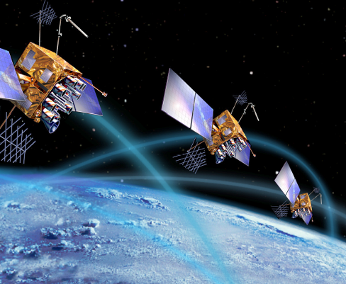
Artist's conception of Navstar GPS satellites in Medium Earth Orbit (MEO)
Historical Evolution
GPS technology has evolved dramatically:
🚚 1981: Receivers were truck-sized! The NASA Jet Propulsion Laboratory had massive equipment just to receive GPS signals.
📱 Today: The same technology fits in your smartphone or a tiny chip.
The underlying principles remain the same — only the size has changed!
Other GNSS Constellations
Following GPS's success, other nations developed their own satellite navigation systems. Today, multiple GNSS constellations operate worldwide:
| System | Country/Region | Satellites | Status |
|---|---|---|---|
| GPS | United States | 31 | Fully Operational |
| GLONASS | Russia | 24 | Fully Operational |
| Galileo | European Union | 30 | Fully Operational |
| BeiDou | China | 35+ | Fully Operational |
| QZSS | Japan | 4 | Regional (Asia-Pacific) |
| NavIC (IRNSS) | India | 7 | Regional (India) |
Why GPS Matters
GPS technology is fundamental to many industries and applications:
- Navigation — Aviation, maritime, ground transportation
- Surveying & Mapping — Land management, GIS, construction
- Timing — Financial transactions, telecommunications, power grids
- Scientific Research — Climate change, earthquake monitoring, atmospheric studies
- Space Applications — Satellite tracking, orbit determination, spacecraft navigation
💡 Fun Fact: Banks, railways, electrical grids, and aircraft rely heavily on GPS not just for location, but for precise timing from the atomic clocks in satellites! GPS has become critical infrastructure for our modern world.
Types of GPS Receivers
GPS receivers come in many forms, from consumer handheld devices to survey-grade equipment. The main differences are accuracy, cost, and the ability to use differential correction techniques:
| Type | Accuracy | Common Manufacturers | Differential Correction | Price Range |
|---|---|---|---|---|
| Recreational/Consumer | ~15 meters | Garmin, Magellan, smartphones | ❌ No (WAAS only) | $50 - $500 |
| Mapping Grade | 1-5 meters | Trimble, Garmin, Bad Elf | ✅ Post-processing | $500 - $5,000 |
| GIS/Professional | Sub-meter | Trimble, Leica, Topcon | ✅ Real-time & Post-processing | $3,000 - $10,000 |
| Survey Grade | 1-2 cm | Trimble, Leica, Topcon, Javad | ✅ RTK (Real-Time Kinematic) | $15,000 - $50,000 |
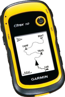
Recreational GPS
Garmin eTrex 10
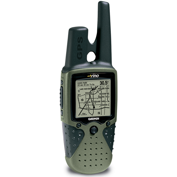
Recreational GPS
Garmin Rino
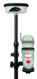
Survey-Grade GPS
RTK-capable receiver
What is Differential Correction? This technique uses a base station at a known location to calculate and correct errors in GPS signals, dramatically improving accuracy from meters to centimeters.
GPS History: How Far We've Come
Today's smartphone GPS fits on a tiny chip, but early GPS receivers were massive pieces of equipment. Here's a fascinating look at how the technology has evolved:
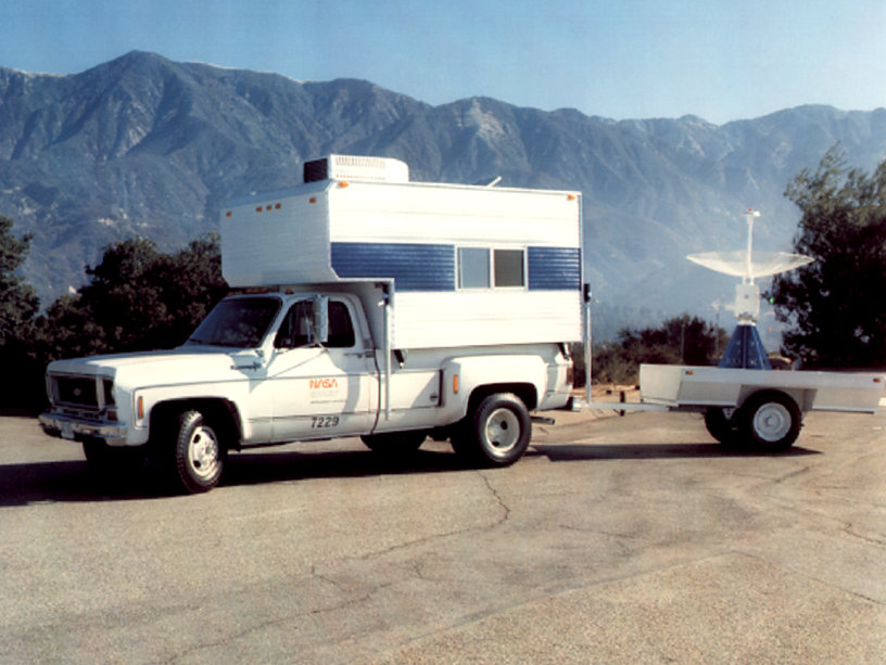
JPL's SERIES (Satellite Emission Radio Interferometric Earth Surveying) codeless receiver, c. 1981. A complete mobile GPS station required a truck and trailer!
From Trucks to Pockets: In 1981, a GPS receiver required an entire truck, trailer, and large antenna dish. Today, the same functionality fits on a chip smaller than your fingernail inside every smartphone. The Arduino GPS module we're building in this workshop represents an incredible democratization of space technology!